Welcome to US Topo Maps - Your Ultimate Outdoor Navigation App
Embark on exciting outdoor adventures with ease and confidence using US Topo Maps. This exceptional app provides you with free access to the finest selection of maps and aerial imagery for the entire United States. Whether you're planning a hiking expedition through the picturesque mountains or a camping trip in the dense forests, US Topo Maps is your go-to companion for offline navigation on your Android device.
Key Features that Set Us Apart:
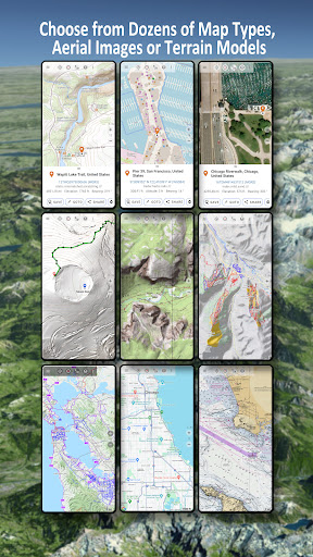
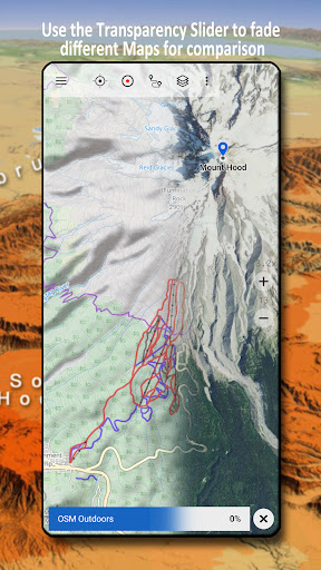
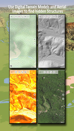
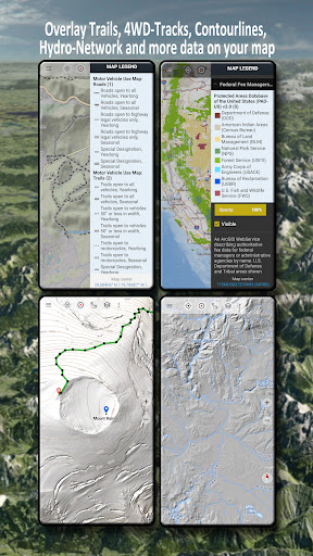
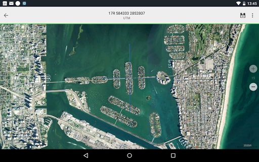
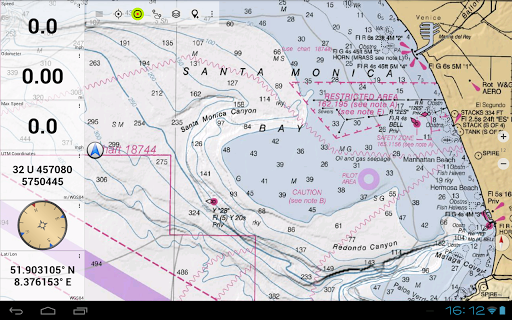
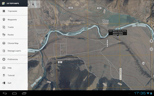
- 30+ Map Layers: With a multitude of map options at your fingertips, including topographic maps, aerial imagery, sea charts, and flight charts, you can effortlessly plan your perfect trip. Take advantage of various map layouts and overlays to find the most intriguing routes and discover hidden gems.
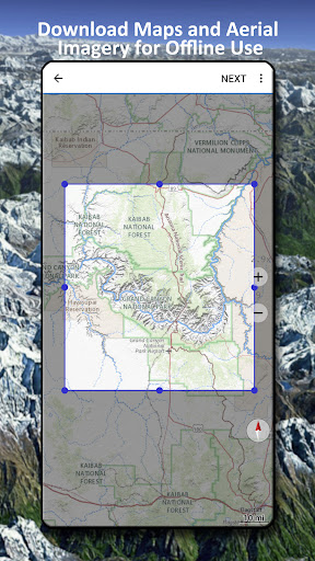
- Seamless Download for Offline Usage: No internet connection? No problem. You can easily download map data to your device and access it offline whenever you need it. Say goodbye to unreliable signals and hello to uninterrupted navigation in the great outdoors.
- Add Maps from Other Sources: Expand your range of maps by effortlessly importing raster maps in various formats such as GeoPDF, GeoTiff, MBTiles, and Ozi. You can also include web mapping services, like WMS or WMTS/Tileserver, and even import OpenStreetMaps in space-saving vector format.
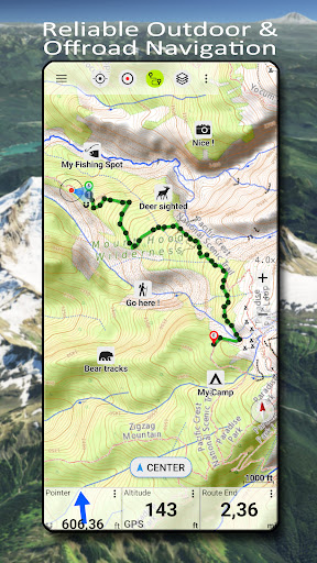
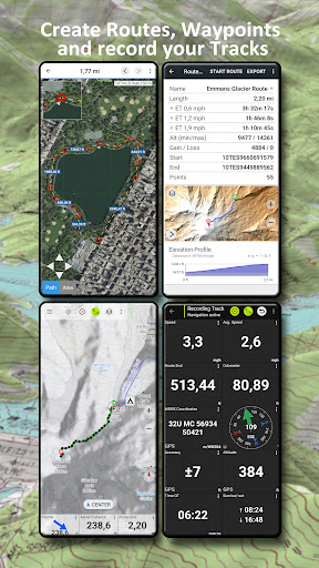
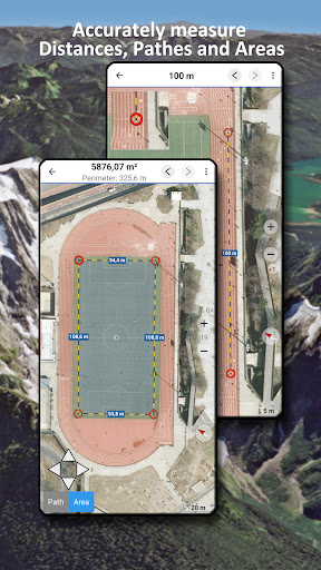
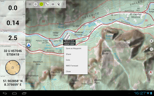
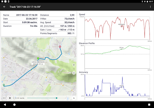
- Precision Tracking and Recording: Stay on course with our advanced navigation features. Measure paths and areas, create and edit waypoints, follow point-to-point navigation, record your tracks with detailed speed, elevation, and accuracy profiles, and utilize the trip master for real-time data updates.
- Robust Search Functionality: Find your desired locations with ease using our comprehensive search feature. Look up place names, points of interest, and streets effortlessly, saving you valuable time and ensuring you never lose your way.
- Seamless Sharing and Compatibility: Share your favorite waypoints, tracks, and routes with friends, family, and fellow adventurers via email, Dropbox, or social media platforms like Facebook. Import and export GPS data in popular formats such as GPX and Google Earth KML/KMZ to collaborate and plan together.
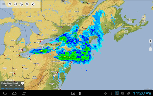
- Real-Time Weather Information: Stay informed with up-to-date weather forecasts from the National Weather Service (NWS), nowCoast weather information, and NEXRAD Weather Radar. Gain valuable insights into temperature, wind vectors, and precipitation patterns to make accurate predictions during your outdoor expeditions.
Developed by ATLOGIS Geoinformatics: Trustworthy, Reliable, Innovative
US Topo Maps is the brainchild of ATLOGIS Geoinformatics, an esteemed company specializing in cutting-edge geospatial solutions. With a proven track record in the industry, ATLOGIS delivers top-quality products that cater to the needs of outdoor enthusiasts worldwide. Our dedication to excellence ensures that you have an exceptional user experience with every interaction.
Pros and Cons: Honesty is Our Policy
We believe in complete transparency with our users, which is why we acknowledge the strengths and areas for improvement in US Topo Maps. While our app offers a vast selection of maps and powerful navigation features, we are continuously working to enhance its performance, usability, and feature set. We value your feedback and actively strive to address any concerns to ensure that your outdoor adventures are unparalleled.
A Fascinating Insight into Our Journey
Behind the scenes, US Topo Maps has emerged from a passion for outdoor exploration. Our team of dedicated individuals at ATLOGIS Geoinformatics poured their expertise and love for nature into developing this exceptional app. We understand the significance of connecting with nature and its profound impact on our lives, which is why we are committed to helping you explore and appreciate the great outdoors.
An App for All Adventure Seekers
US Topo Maps is designed for outdoor enthusiasts of all ages who thrive on thrilling activities like hiking, biking, camping, climbing, skiing, canoeing, hunting, and search and rescue operations. Our app empowers you, whether you're a beginner or an experienced adventurer, by providing a comprehensive navigation tool that ensures your safety, convenience, and ultimate enjoyment.
Technical Details:
- Version: Varies with device
- Size: Varies with device
- Compatibility: Varies with device
A Unique Perspective on Outdoor Navigation
US Topo Maps presents an innovative and captivating approach to outdoor navigation. By offering a diverse range of maps, powerful features, and real-time weather information, we stand out from the crowd. We are committed to providing you with an unforgettable outdoor experience that combines the wonders of nature with the convenience of cutting-edge technology.
Download US Topo Maps today and unlock a world of excitement and exploration right at your fingertips!
For any questions, comments, or feature requests, feel free to reach out to us at [email protected]. We'd love to hear from you!